Low Elevation Coastal Zone Global Delta Urban-Rural Population and Land Area Estimates Version 1March 2023
| Overview |
|---|
| The Low Elevation Coastal Zone (LECZ) Global Delta Urban-Rural Population and Land Area Estimates dataset provides country-level estimates of urban, quasi-urban, rural, and total population (count), land area (square kilometers), and built-up areas in river delta- and non-delta contexts for 246 statistical areas (countries and other UN recognized territories) for the years 1990, 2000, 2014* and 2015. This data set was prepared for an article entitled “Is rapid urbanization of low elevation deltas undermining adaptation to climate change: a global review" (McGranahan et al. 2023). Understanding patterns of human settlements along the coasts, and particularly in deltas where climate hazards will intersect with other biogeophysical challenges, is important for assessing and mitigating risk. Population estimates are disaggregated such that compounding risk factors such as elevation, settlement patterns, and delta zones can be cross-examined. Estimates of populations living in 5m and 10m LECZs (as well as outside of LECZs) can be used to inform planning and policy making decisions based on perceived exposure and vulnerability (risk tolerance) to potential damages from sea level rise and storm surge. Though major deltas only account for about 0.5% of the world’s land area, in recent years land use patterns in these deltas have intensified at a much greater rate than the rest of the world. Several very serious hazards, most notably flooding, are prevalent in low elevation coastal areas and especially deltas. People and economic capital are also more concentrated in these areas, and this concentration may be growing. Coastal and estuarine flooding is already an important category of disaster, and the latest report by Working Group II of the Intergovernmental Panel on Climate Change (IPCC) concludes that, “Risks to coastal cities and settlements are projected to increase by at least one order of magnitude by 2100 without significant adaptation and mitigation action (high confidence)” (IPCC 2022, page 63). Global climate change and environmentally harmful development are increasing the severity and extent of environmental hazards, placing people, property and environmental resources in these areas at still greater risk. These data define greater-risk zones using: 1) the global extent of two low elevation zone contiguous to the coast, one bounded by an upper elevations of 10 metres (LECZ10), and another by upper elevations of 5 metres (LECZ05); 2) the extent of the world’s major deltas; 3) the distribution of people and built-up area around the world; 4) the extents of urban centres around the world (with statistics based on other generally smaller and less densely settled urban areas, such as towns and suburban or peri-urban land forms). The different data sets are layered spatially, along with political and land/water boundaries, allowing the densities and quantities of population and built-up area, as well as levels of urbanisation (defined as the share of population living in “urban centres”) to be estimated for any country or region, both inside and outside the LECZs and deltas, and at two points in time (1990 and 2015). Explore the spatial data with an interactive mapping application. |
| Download |
Data download includes:
|
| Methods |
|
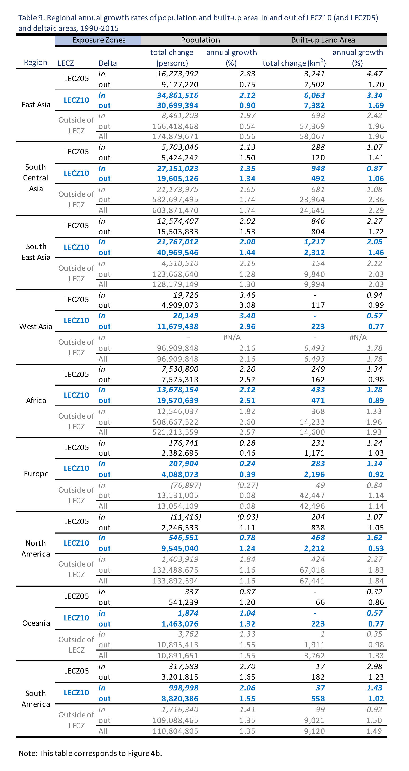
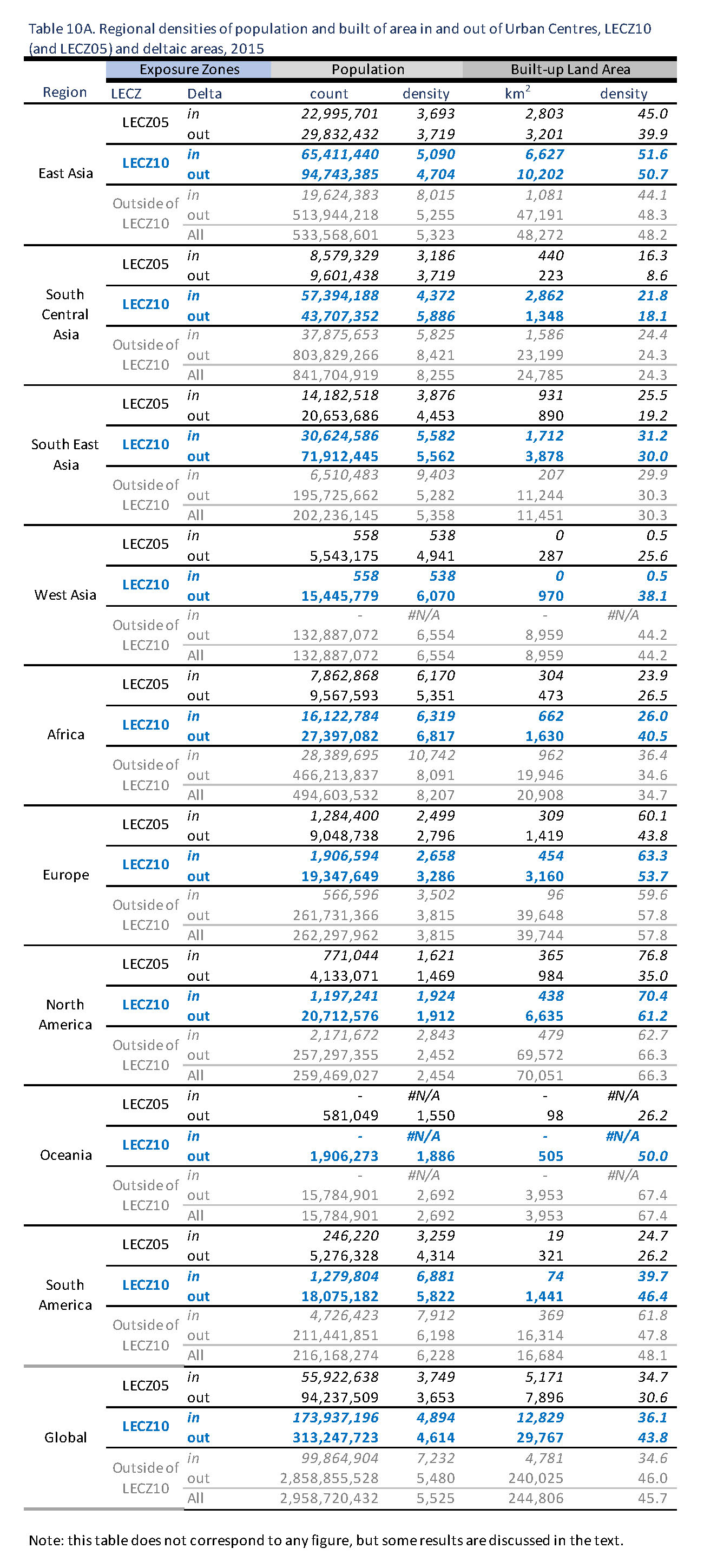
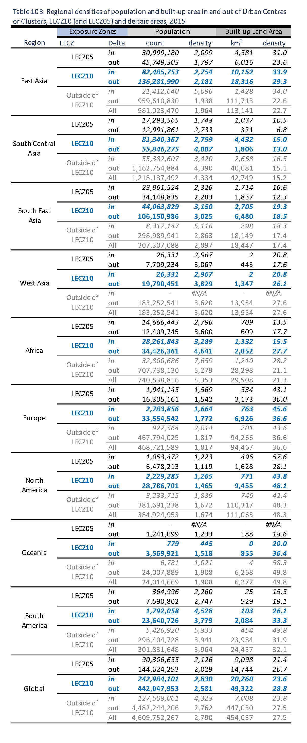
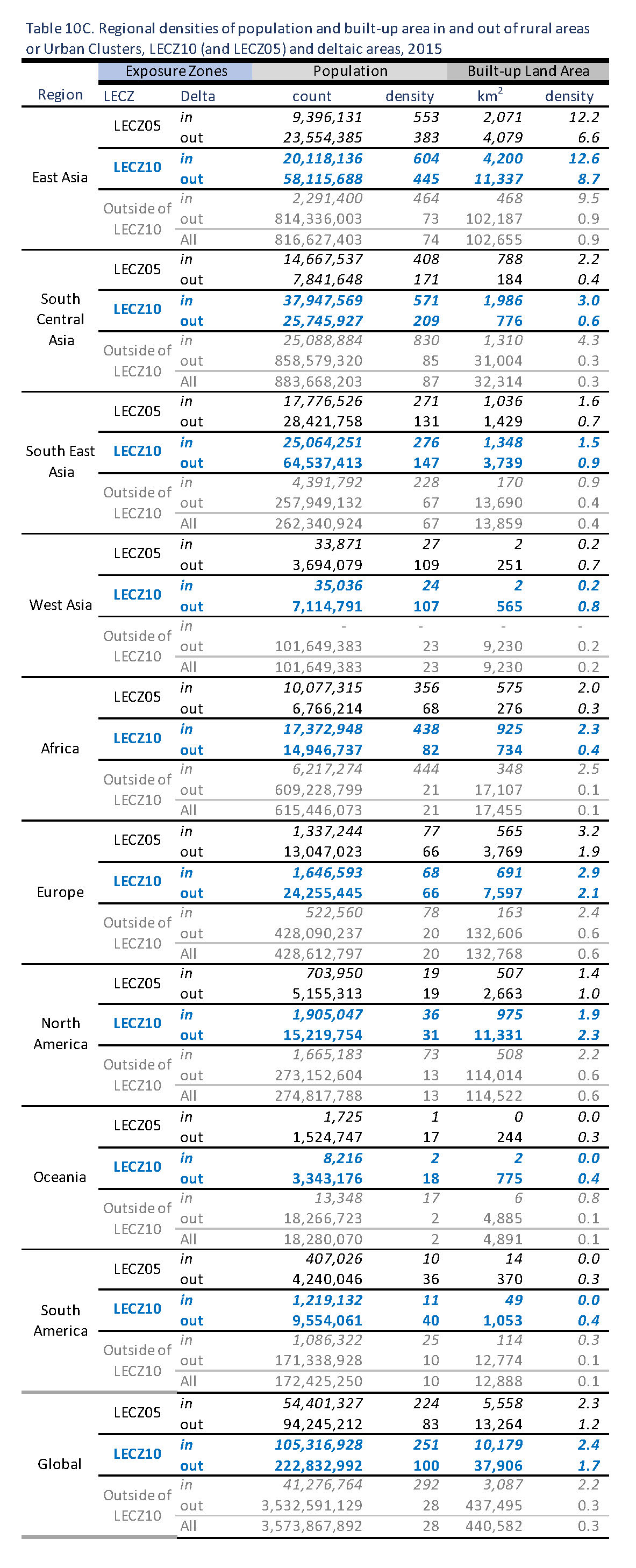
Low Elevation Coastal Zones version 3 (LECZ v3) from MacManus et al. (2021). Elevation assessments are based on the Multi-Error-Removed Improved Terrain Digital Elevation Model (MERIT DEM). Raster, 9 arc second resolution, 3 classes (0-5 metres LECZ05, 5-10 metres LECZ10, and outside LECZ); year 2000 (MERIT is 3 arc second in original form). For urban extents, MacManus et al. (2021) uses the classification “urban” (U), “quasi-urban” (Q) and “rural” (R) for comparison across four different data sources some of which are continuous variables with no previously stated categorizations. These correspond to “urban centres”, “urban clusters” and “rural” in the associated paper. Global delta area extents from Tessler et al. (2015). Forty-eight major delta areas were defined in vector format in the WGS84 equirectangular (geographic) coordinate system. Population summaries designated as “inside delta” are extracted from these extents. These data only include major deltas, which account for about a fifth of the LECZ10. A significant share of the urban population in the LECZ10 that is not in these major deltas is likely to be at other river mouths, often on smaller deltas. Population estimates for 246 countries and territories are from the Global Human Settlement Layer (GHSL) R2019 collection, Gridded Population of the World version 4.11 (GPW4) for years 1990, 2000, and 2015. WorldPop, and ORNL LandScan for years 2000 and 2015. Built-up areas are from Global Human Settlement built-up grid R2018A (GHS-BUILT, Corbane et al. 2018). Raster, 9 arc second resolution, percentage of detected built-up; 1990, 2000, 2014. * GHS-Built is produced for the year 2014, but population estimates reference the year 2015. |
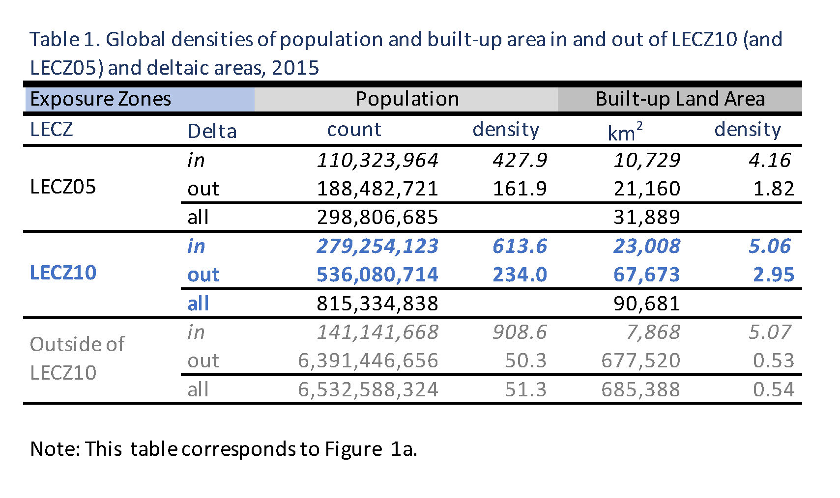
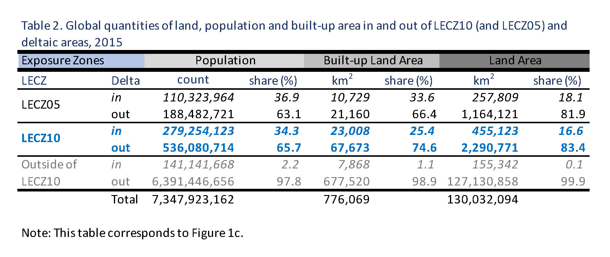
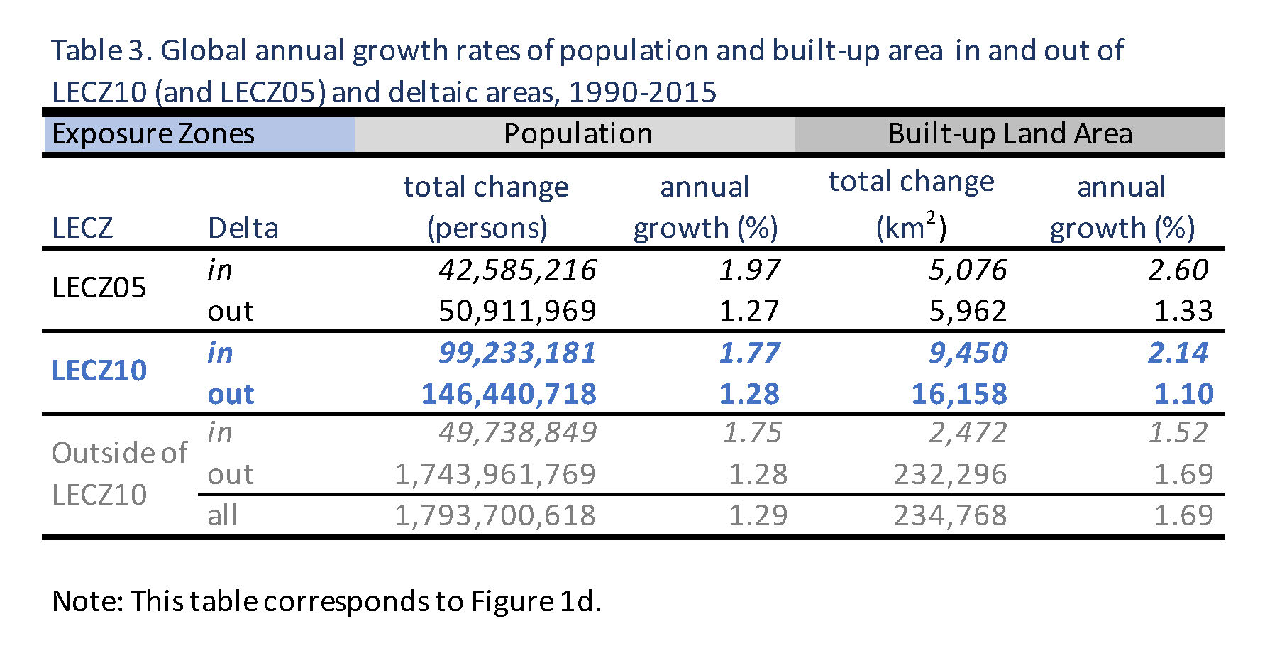
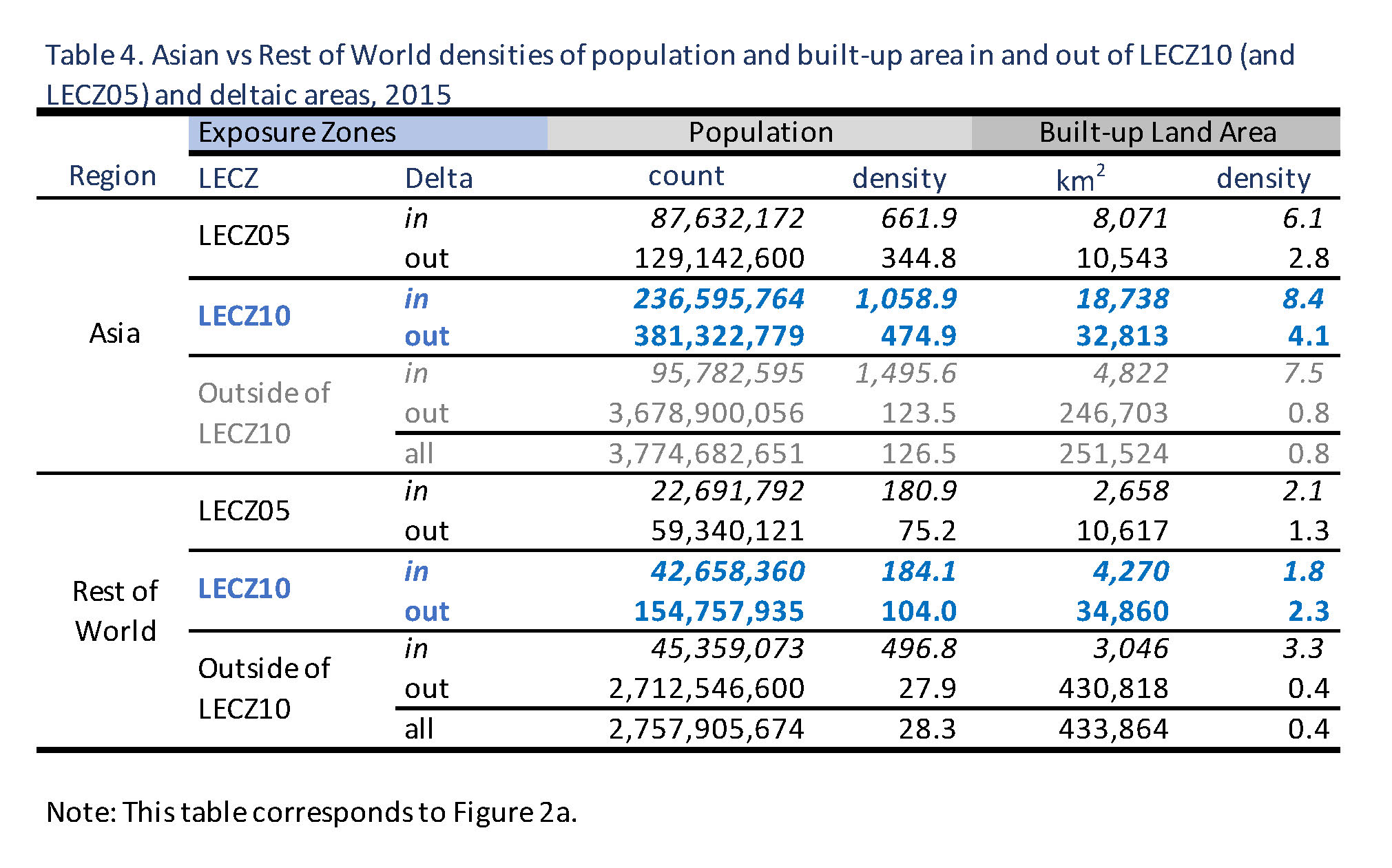
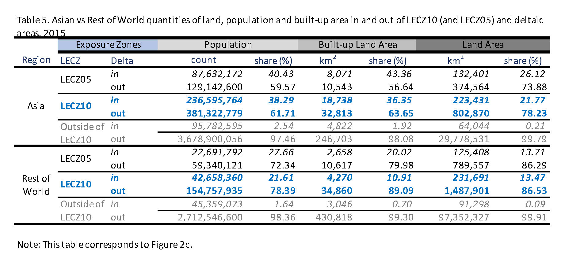
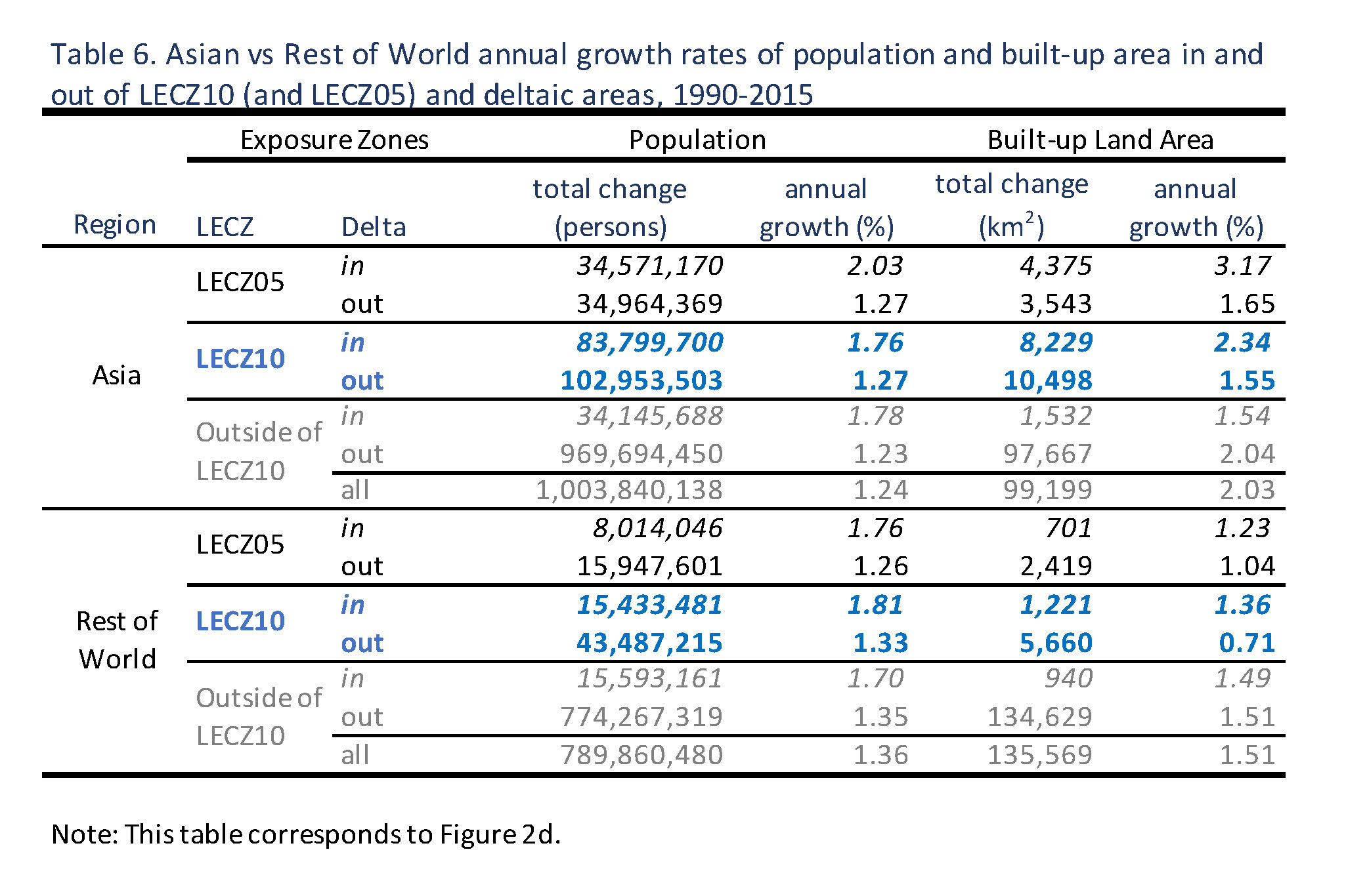
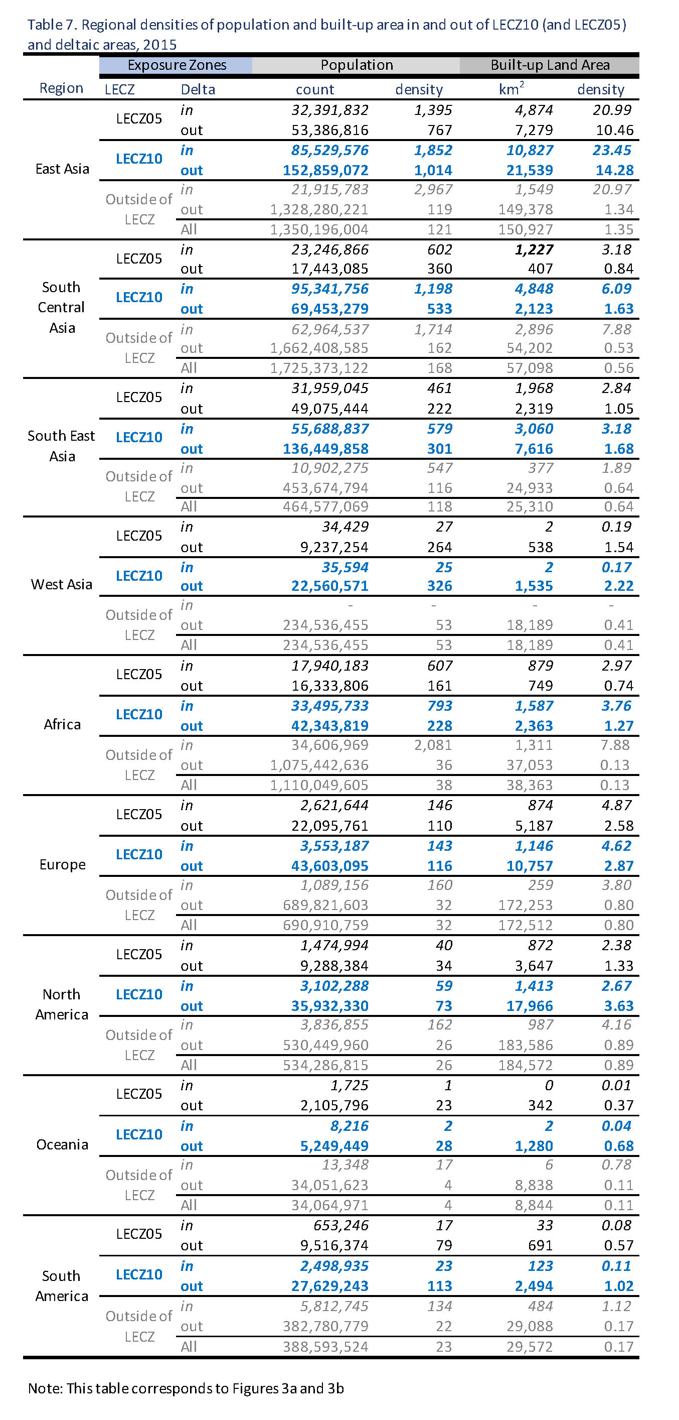
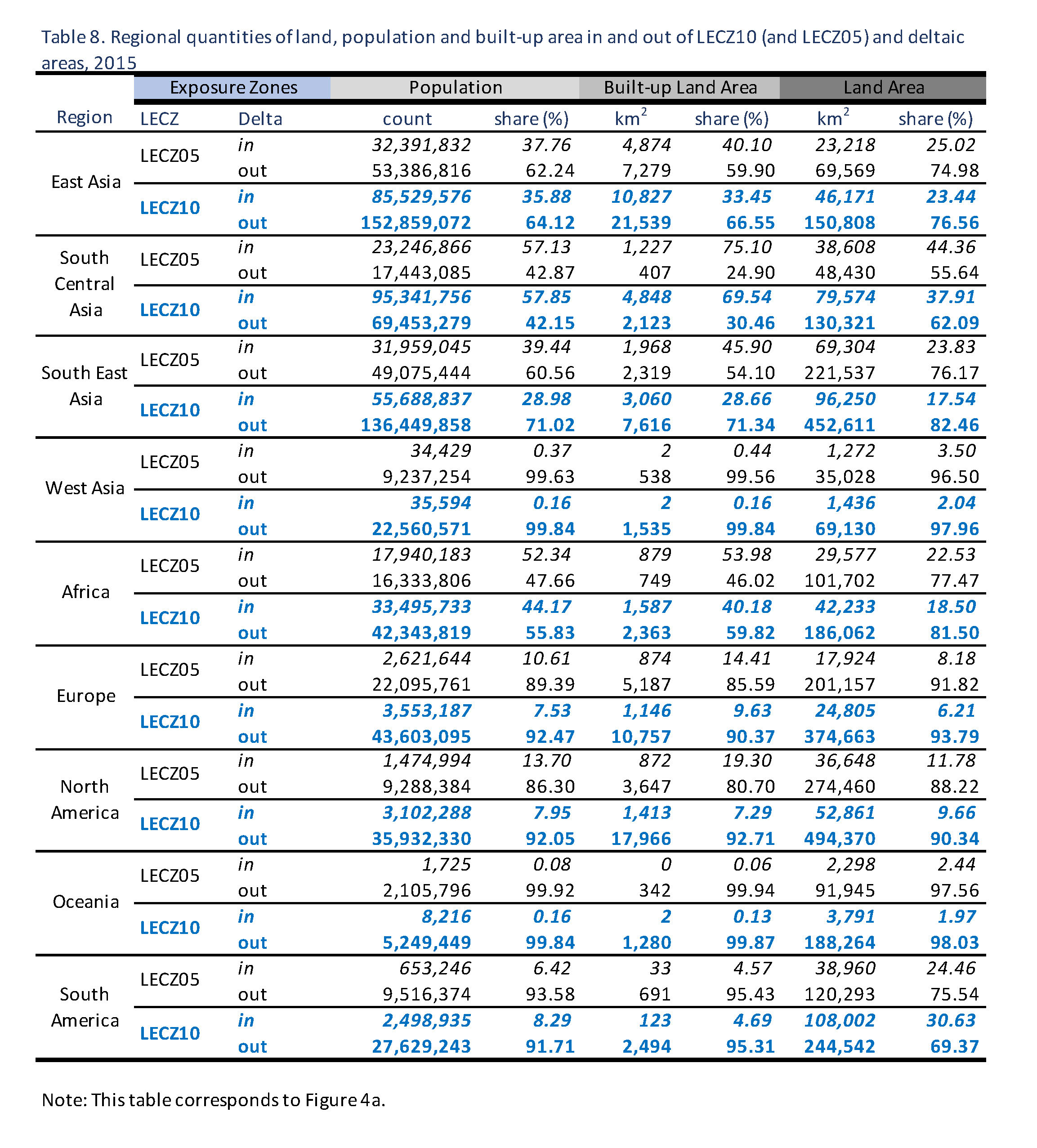
| Tables |
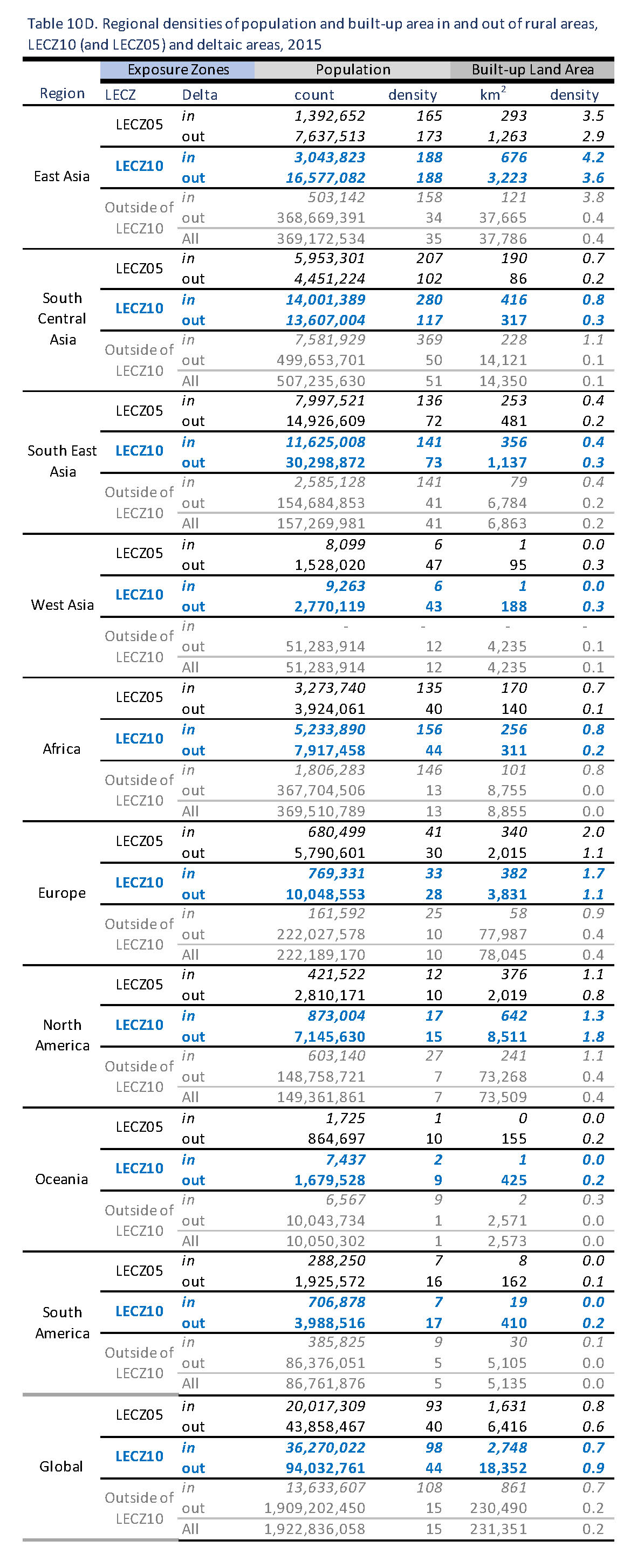
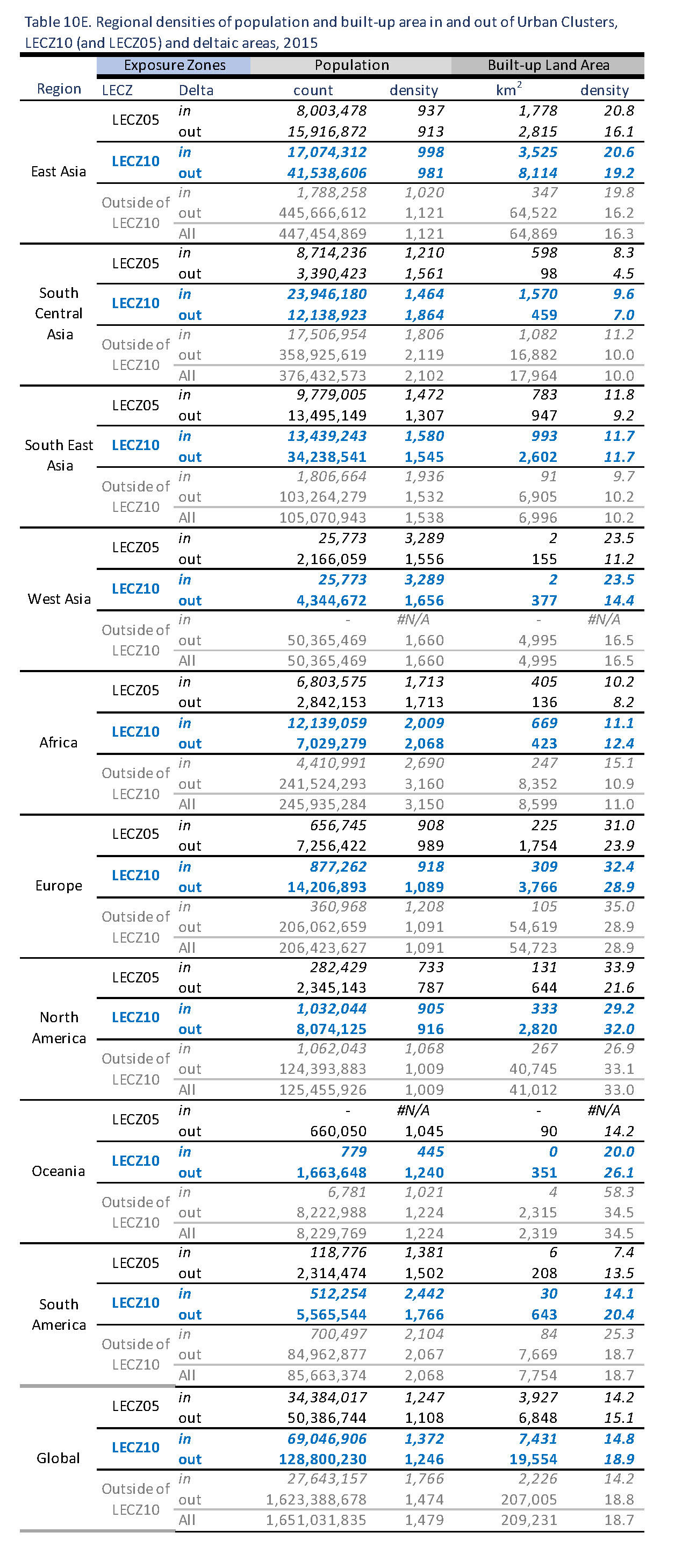
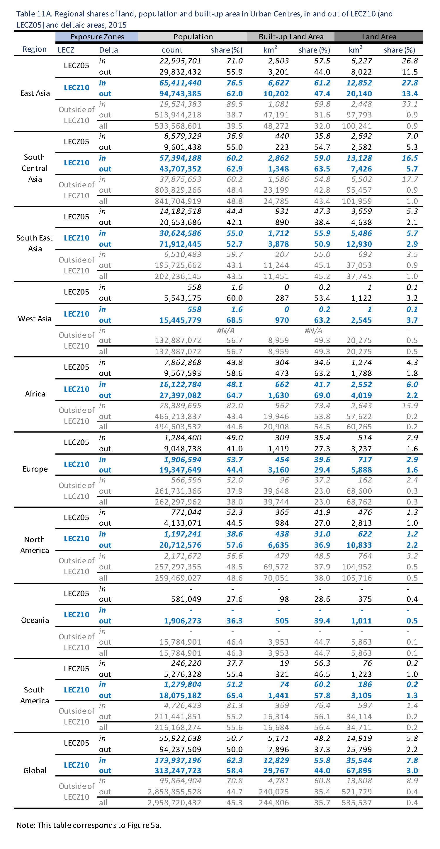
|
Click each table for a full-resolution image. All 45 tables are available for download in XLS/CSV format. |
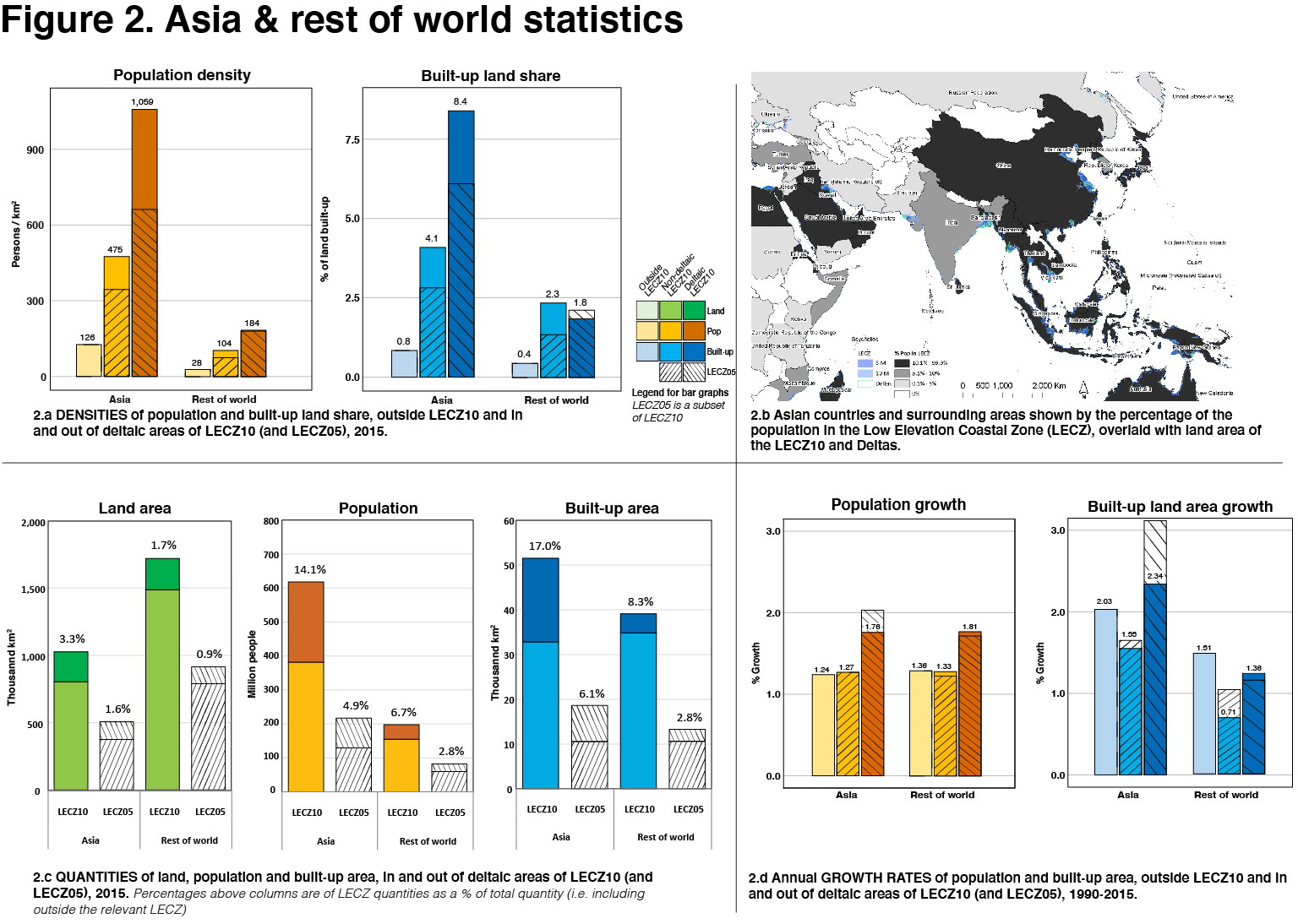
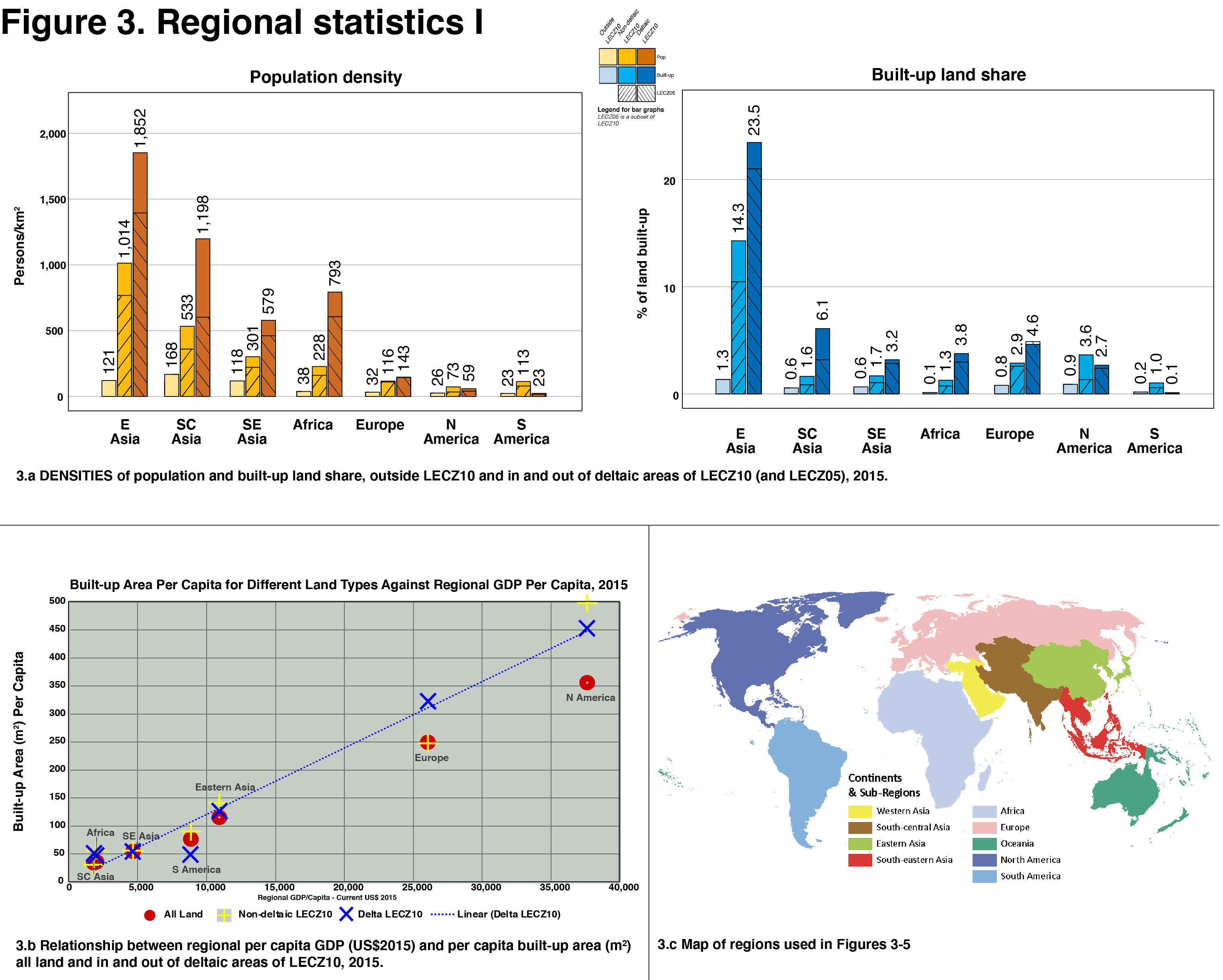
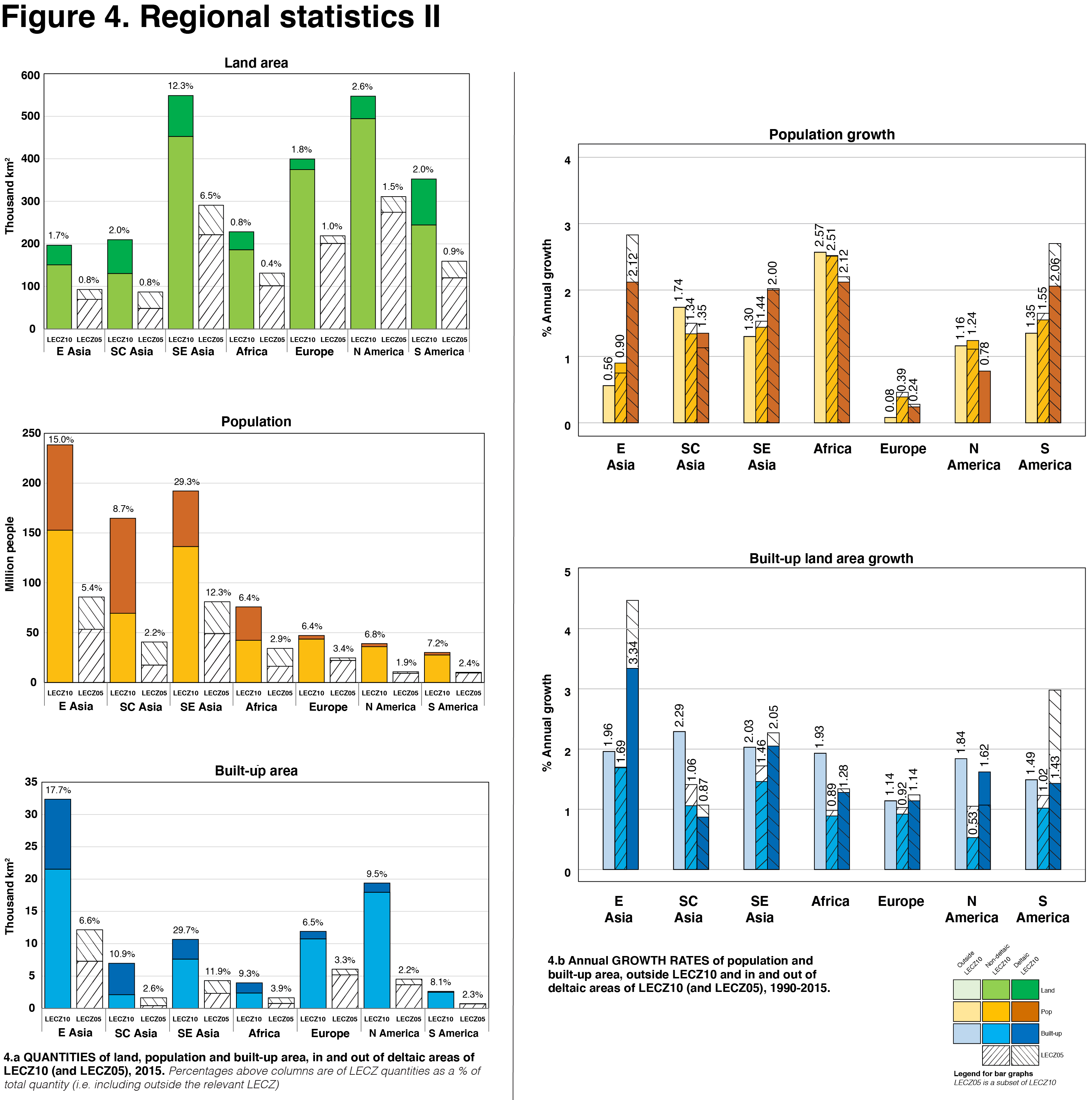
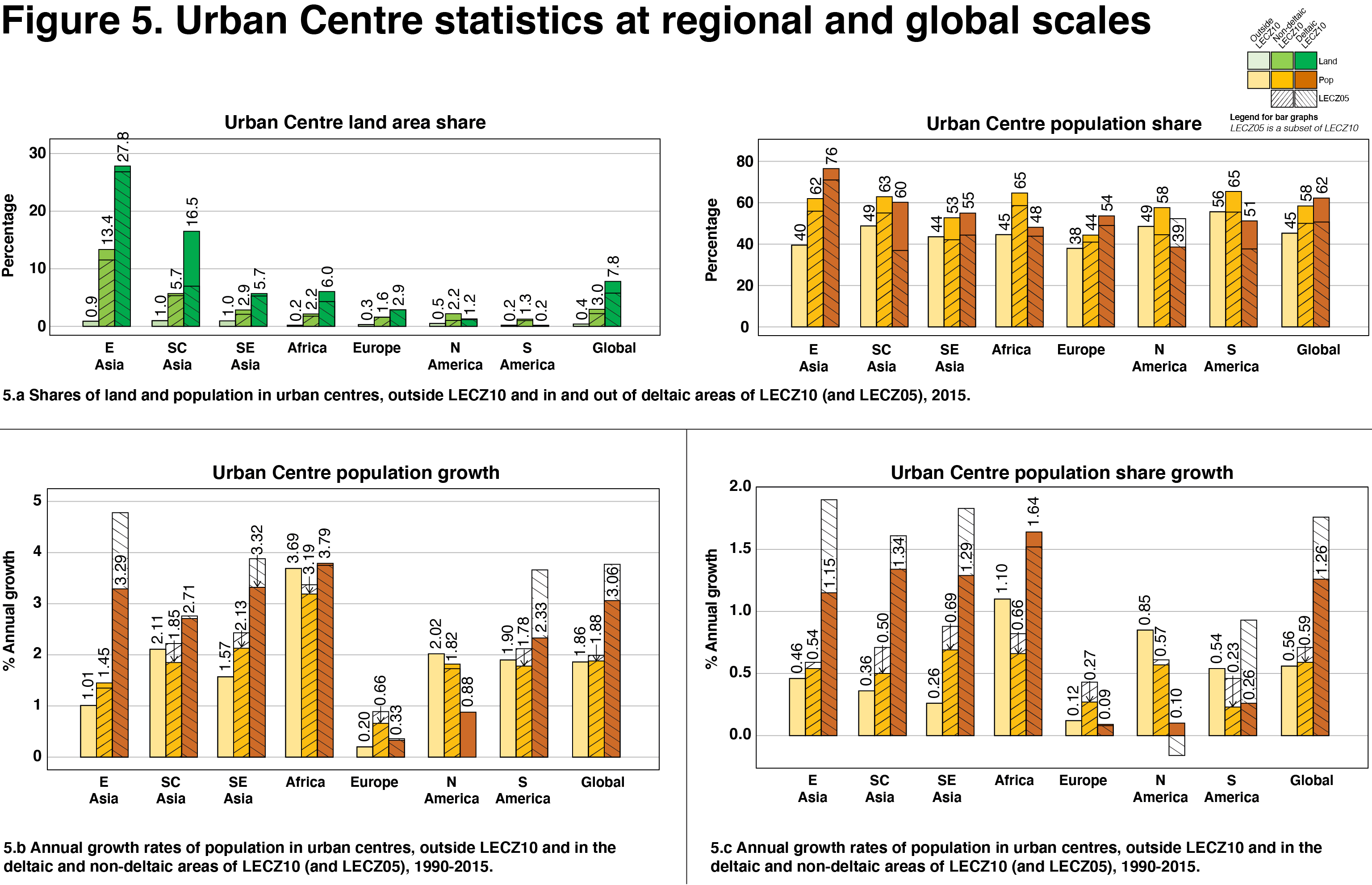
| Figures |
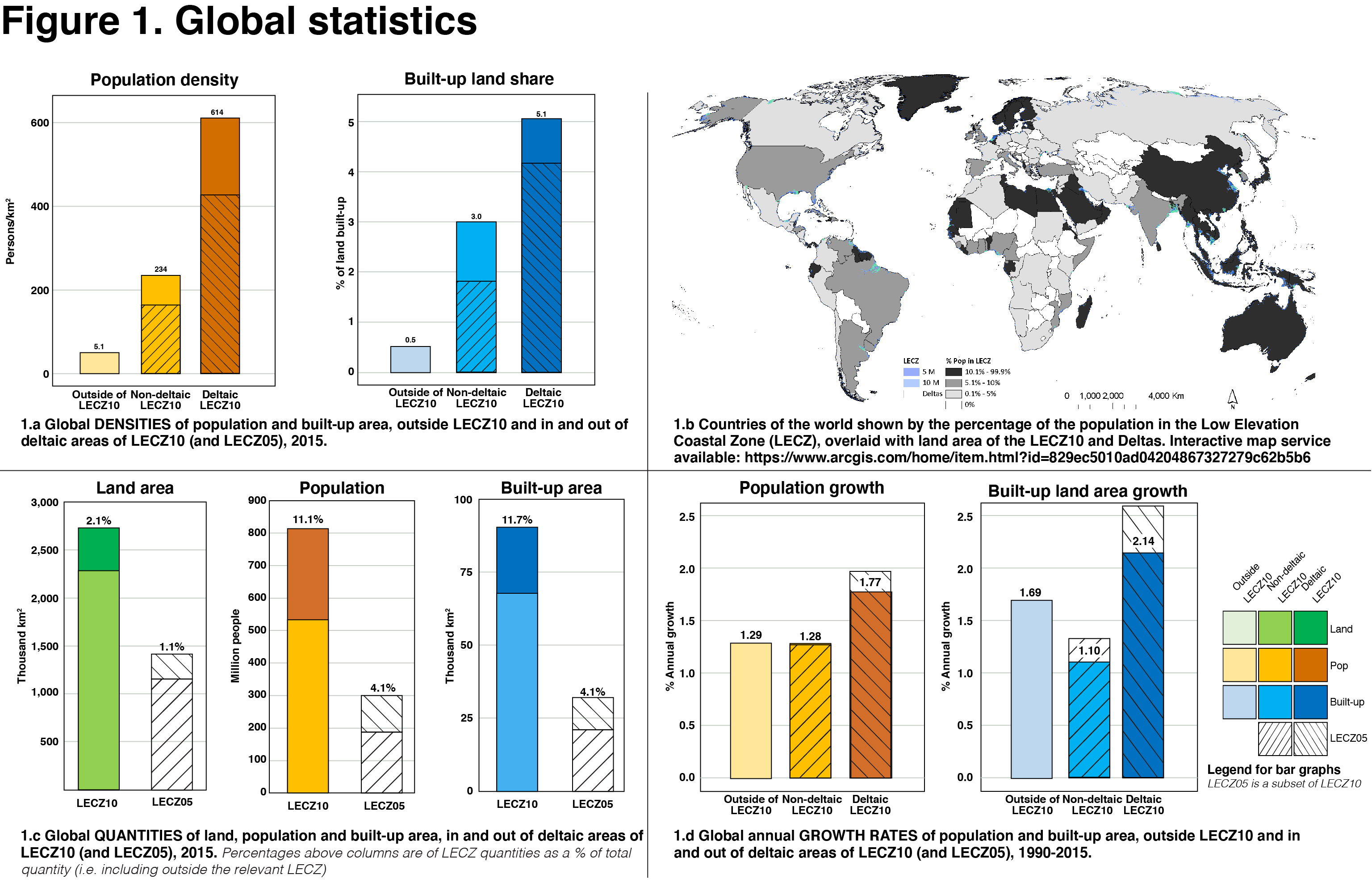
|
Click each figure for a full-resolution image. |
| Citation |
|
The tables and (slightly differently formatted) figures on this page were first published as part of McGranahan, G, D Balk, S Colenbrander, H Engin and K MacManus (2023), ‘Is rapid urbanization of low-elevation deltas undermining adaptation to climate change? A global review’, Environment and Urbanization, 26 September, Sage, available at https://journals.sagepub.com/doi/10.1177/09562478231192176, where Supplementary Material can also be found. The paper is published under a Creative Commons Attribution Non-Commercial license (CC BY-NC). Citations of the tables and figures should include this article as the original source. Center for International Earth Science Information Network - CIESIN - Columbia University, and CUNY Institute for Demographic Research - CIDR - City University of New York. 2021. Low Elevation Coastal Zone Global Delta Urban-Rural Population and Land Area Estimates (1990, 2000, 2014, 2015) Version 1. Palisades, NY: NASA Socioeconomic Data and Applications Center (SEDAC). DOI: https://doi.org/10.7927/4hgr-db70. Accessed DAY MONTH YEAR. |
| Disclaimer |
|
This is a preliminary open data release. Over the coming months data curation will be completed by the NASA Socioeconomic Data and Applications Center (SEDAC) and the data will be disseminated through the SEDAC catalog. |